All of Denmark in one map. Answers at plot level.
Explore the whole country with 300+ data layers. Click a plot and get ownership, sale prices, planning, land registration and environmental data in one place — built for fast, data-driven qualification of potential projects.
300+ data layers. From ownership to flood risk — gathered at plot level.
Where most maps show one layer at a time, Arcili brings them together on the same plot. Every layer is pulled from public registers and updated daily — so you screen a site in minutes instead of checking ten systems.
Turn on only the layers a given case needs.
- Owner & company Ownership · CVR relations · company hierarchy
- Sales & price Sale prices · price trend · price per m²
- Planning Local plan · municipal framework · sub-area rules
- Land registration Title · easements · documents
- Environment & risk Soil contamination · flooding · cloudburst
- Noise Road · rail · air · industry
- Cultural heritage Listing · conservation value
- Building & terrain BBR · 3D buildings · elevation model
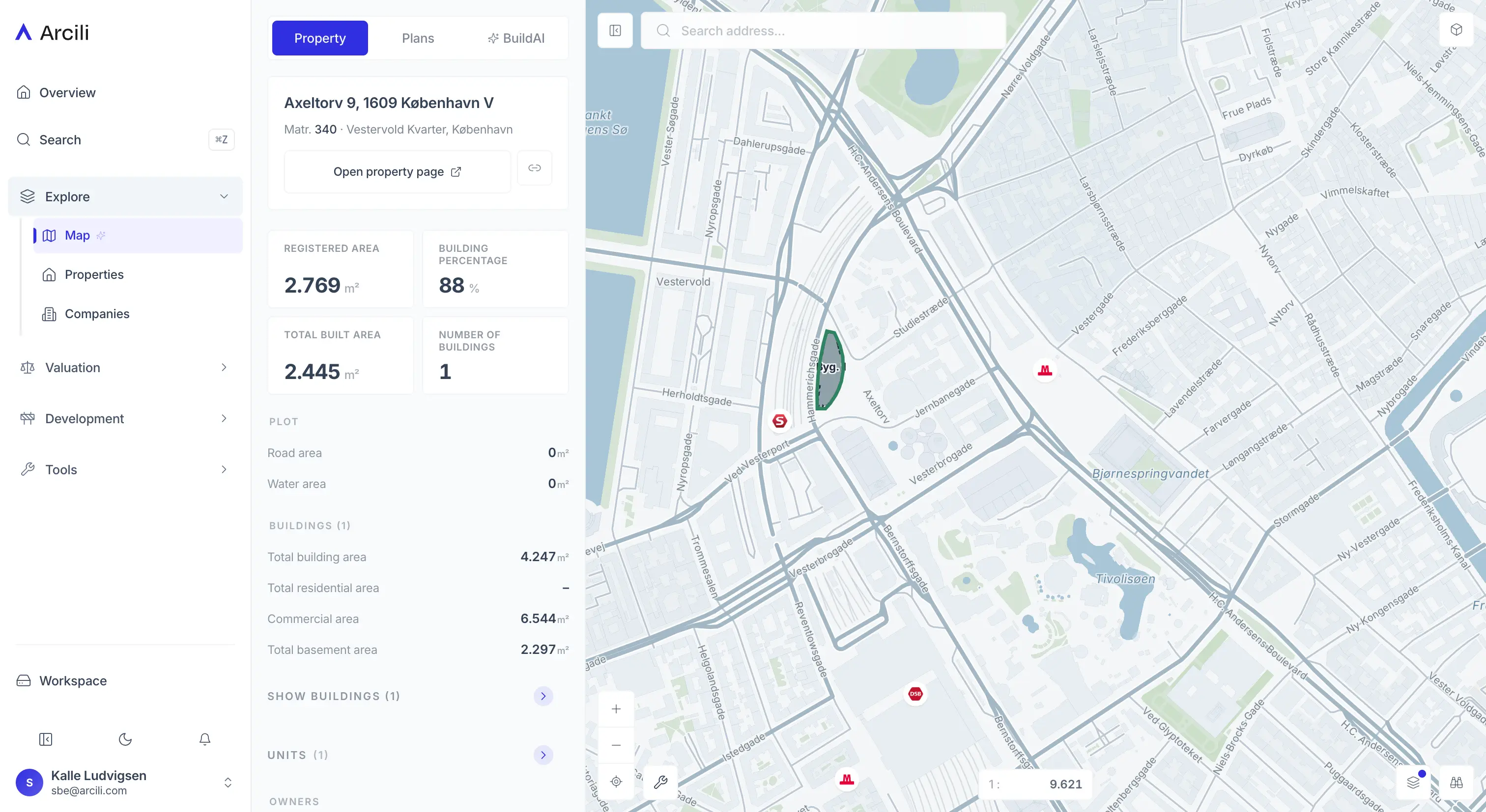
Click a plot. The full picture assembles on the spot — ownership, deals, planning and environment.
From one click to the full picture.
Select a plot and Arcili gathers the information from ten separate registers into one panel — ready to act on.
Fetched with one click
- Ownership
- Sale prices
- Local & municipal plan
- Land registration documents
- Contamination status
- Sub-area rules
- +3 more
Tools in the map. View in 3D with a sun study, and draw and measure right on the plot.
3D · sun study
3D & sun study
See buildings and terrain in 3D right in the map, and run a sun study showing shadow cast hour by hour across the year. Assess scale, heights and overshadowing without leaving the plot.
Polygon · measure tool
Draw & measure
Draw a free polygon to delimit an area, and measure distances and areas right in the map.
Massing · 3D
Massing study
Place building volumes on the plot and see storeys, footprint and build-out ratio — test what fits, in 3D.
Ready for more effective decisions?
Pricing adapts to your team, roles and usage — from single user to enterprise with SSO. No commitment to see the platform.
We reply within 24 hours on business days
[email protected]